Winds for kitesurfing in the Balearic Islands
Continuing with the blog on meteorology, we upload this new thopic, more specifically, the winds affecting southern Europe, winds in Mallorca and the Mediterranean and especially the winds on the Balearic Islands.
The winds is always called by the direction from which arrives, never to where they go and as we know, in each zone they take a different name.
In the Mediterranean are characteristic long periods of gentle winds alternating with episodes of strong winds, accompanied by bad sea conditions.
Strong winds do not usually blow during the summer months, except on rare occasions, but are characteristic of winter and sometimes autumn.
WINDS OF THE MEDITERRANEAN
1- Tramontana N
2- Gregal NE
3- Llevant E
4- Xaloc SE
5- Migjorn S
6- Llebech SW
7- Ponent W
8- Mestral NW
Tramontana
Wind coming from the North
Etymologically the word Tramontana comes from the Latin and means beyond the mountains. This wind usually occurs when the isobaric situation originates in the Gulf of Leon and in the sea on the Balearic Islands, it is also characterized by the presence of a storm in northern Italy.
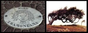
This situation usually evolves from the evolution of an Atlantic front when reaching the warm waters of the Mediterranean or the evolution of a NW wind situation in which the main storm moves from the British Isles in NW-SE direction thanks to that the position of the Azores anticyclone does not have a significant influence on the peninsula.
Because of this, the Tramontana is produced in the north of the Pyrenees and the southwest of the French Massif Central, which in turn acts as an acceleration zone. The Tramontana can last several days with winds characterized by strong gusts.
When this wind blows the sky usually presents a deep blue color. The temperature drop is remarkable and conditions for navigation in the Gulf of León and north of the Balearic Sea are worsening. In the area of the Cape of Creus is where they usually register the more intense rages, that often surpass the 40 knots.
Gregal
Wind coming from the Northeast
The name, Gregal, comes from the old sailing sailors Catalans and Aragonese who used it in their trips to Greece. The Gregal is a wind characteristic of spring, summer and autumn, and can result as much from an evolution of a situation of Tramontana as from Levante.
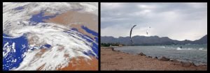
The Gregal is considered one of the characteristic winds of the Balearic archipelago, where it blows cold and dry because of that comes from the continent. In winter is usually given when the anticyclone of the Azores is extended towards the British islands and a storm is located in the zone of Italy and the Balkans.
In this situation a continental cold air current is formed which causes the so-called cold waves that preferentially affect the eastern half of the peninsula.
During the Gregal, the air is relatively dry, reason why it generates little clouds and less precipitations. The situations usually persist for about 4 days on average and the wind, in these cases, usually does not exceed 20 knots.
Llevant
Wind coming from the East
The situations of levante are the most peculiar meteorologically and of greater transcendence climatic in the Mediterranean coast of the peninsula and in the Balearic Islands.
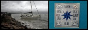
It occurs when an anticyclone is centered in the area of France or Germany and a depression is situated in North Africa. Depending on the course of the wind over the sea, the Levante wind is more or less humid, with variations in rainfall, which can sometimes become very strong if the wind arrives wet and in the upper layers of the atmosphere there is cold air.
Llebech
Wind coming from the Southwest
The Garbí is the name with which in the Spanish southeast and southeast the wind blowing from the southwest is known. Because of its origin, it frequently comes with sand and dust in suspension because it comes from the Sahara desert.
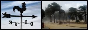
The llebech is a wind direction SW and is produced by the displacement of the storms in the Mediterranean south from west to east. This displacement causes the movement of masses of warm, dry air from the Sahara to the southeast of Spain.
This wind is anticipated by the appearance of the calima in the horizon towards the south. The characteristic color of the calima is caused by the large amount of dust that it carries.
The appearance of this wind announces the arrival of a depression that sometimes brings storms and rain. The duration of the Siroco can be of only a few hours, 10 or 15 hours until arriving to last several days.
Ponent
Wind from the West
In Mallorca, the west wind is quite more frequent in winter than in summer but when it does, it causes an increase in temperatures and creating a dry environment.
The West reaches special intensity when there are several storms in the Atlantic. In these cases, the coasts of the Spanish Levant receive the maximum warmness and dryness of the air when descending from the center of the country to the coastal plains, reaching relative humidities very low.
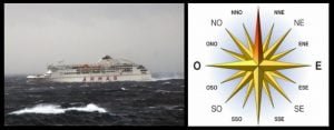
In the Balearic coasts the West gives rise to strong waves. If this situation occurs in spring, summer and early autumn, these days expect greater rise in temperatures and dry environment.
Mistral
Wind coming from the Northwest
The Mistral is a good example of a cold and dry wind. It is the consequence of the cooling of the air on the mountains by the presence of systems of high pressures in the European northwest.
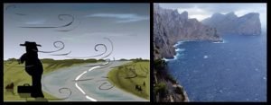
The polar air flows towards the low pressures of the Mediterranean and when encountering the relief of the Pyrenees, the French Massif Central and the Alps suffers an increase in its speed due to the tunnel effect that is created in the valley of the Rhône in France and reaches the peninsula by the Ebro valley.
This situation includes the source of a system of low pressure that is formed in the Gulf of Genoa, resulting in the arrival of North winds and causing a strong swell in the space of sea that separates the peninsula from the islands.
Thermal wind in Mallorca
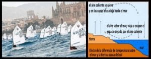
Atmospheric conditions characteristic
of the Mediterranean in summer
The Mediterranean is not usually a place of passage of depressions during the summer, there are basically no areas of squalls at that time of year and weather is generally stable and linked to the warming of mainland Spain or North Africa.
On the other hand, it is common for the Azores anticyclone to push a depression towards the Western Mediterranean, so in the summer months this usually results in the following:
A – a thermal depression depending on the insolation of the Iberian peninsula.
B – a thermal depression over North Africa.
C – an anticyclonic zone to the south of the western Mediterranean.
D – a weak gully zone located to the north of the western Mediterranean.
E – an anticyclonic zone on the center of the Mediterranean.
